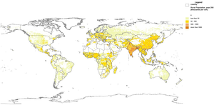
 The Digital Water Atlas was launched on 21 February 2008. The Atlas currently contains 50 global maps and data sets on water-related topics and more than 100 links to other data and information sources. The purpose and intent of the ‘Digital Water Atlas’ is to describe the basic elements of the Global Water System, the inter-linkages of the elements and changes in the state of the Global Water System by creating a consistent set of annotated maps. The project will promote the collection, analysis and consideration of social science data on a global basis.
Further Information:
- Comments and contributions are welcomed directly via the website: Digital Water Atlas